It is unclear to me why I thought a 20 kilometer walk, seriously uphill, on volcanoes was a good idea. I do like hiking, but this …
We started at 9 AM at 1,120 meters. Three hours later we had climbed to 1650 meters (1600m is a mile). Ninety minutes later we had reached the apex, 1886 meters. Then began a four hour decent down to 760 meters. We walked off the trail at 630 PM.
In imperial this translates to, “We started, climbed half a fucking mile upwards, and then back down 350 stories in 9 hours. On purpose. For fun.”
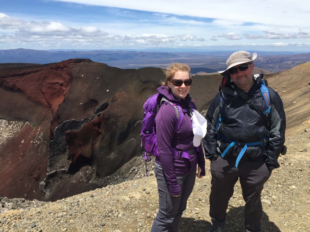
Our guide, Terry, was great. He talked constantly, which helped alleviate the shortness of breath and chest pain I continually experienced. He owns his own business and has led guided walks since 2004. I can’t imagine doing that track several times a week.
In many ways, we’re kindred spirits. We shared the same political views, world views, social views, and life views. We have a general fascination with geology and the outdoors, with a stunning intolerance for emotionally immature, drama prone idiots. We both disliked school, but played the game well enough. Both know how soul crushing unemployment feels. We both are terrible employees — obstinate and mouthy with a piss poor ability to sugar coat — thus he became a small business owner whereas I cause no end of grief to my bosses, who will eventually tire of my antics and let me go. No children. Neither of us particular career driven, both keen on the overlooked aspects of a good life, like free time and quiet. Suffusive to say I liked Terry. I really wish I had an opening for “cool uncle” in my family.
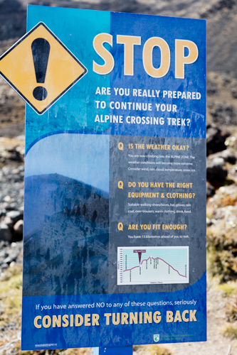
This walk made both RBD and I feel apprehensive. While very popular, 20 kms through tough terrain and remote wilderness must be taken seriously. Both of us trained and prepared ourselves. Having Terry with us for information, but also safety, felt prudent.
Several people were not prepared. You can fake it for a few hours, but eight hours in we saw a few meltdowns. Terry also does search and rescue, so he had some funny (but not funny) stories of morons (mostly Germans and Israelis for some reason) doing super-stupid things and then needing rescue.


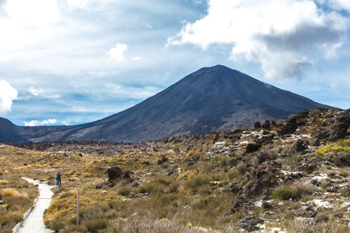


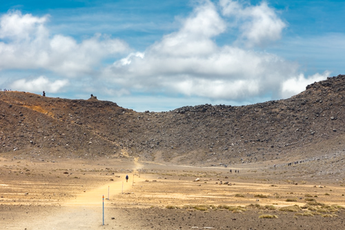

Most think The Taupō Volcano, now filled in with Lake Taupō, erupted 26,500 years ago and caused an ice age. It last blew in 180 AD, which sent enough rock into the atmosphere to cover the Roman and Chinese Empires, as well as the world. They wrote about it, confused as to why the sun darkened for several weeks. It is one of the most violent eruptions ever in the last 5000 years. The eruption in 180 AD is also why there is no vegetation in these pictures. The eruption created so much pumice, it buried the top soil. Without top soil, seeds could not take root. Hence this area is an alpine dessert, though not because of lack of water. Just a lack of arable soil. Farming is nearly impossible.
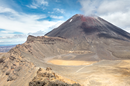
There is plenty of geothermal activity in this area, so the volcano is considered dormant rather than extinct. This entire region sits atop remarkably little crust. It’s only 4 or 5 kms thick, which is essentially nothing. Hence all the activity. Magma is not far away anywhere around here. Usually continental crust is between 30 and 50 kms thick.

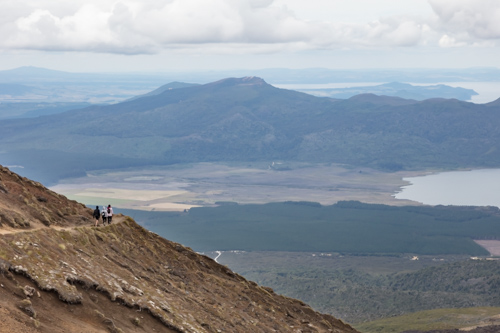
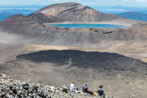
Our decent begins. The trail ends near the tiny, white sliver just below the dark, forested area. We have a long way to go. The far lake beyond the ridge is Lake Taupo, where people just casually go about their recreational activities cool with the fact it’s a caldera. It has a surface area of 600 square kilometers, or about the size of Singapore, and is one of the largest fresh water lakes.
The downhill section lasts for a long time.


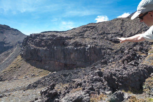
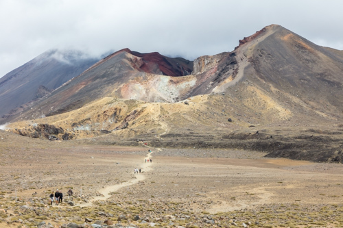
The switch backs are numerous. This face of the mountain was pummeled by rocks in 2005 and 2006 from a nearby volcano, different than any we’ve spoken about already. Massive pot-marks dot the landscape, as well as 3 ton rocks which clearly belong miles away. Thus, nobody is allowed to camp here anymore, as it’s deemed too hazardous. The hut you see in the picture had a rock fall through the roof. Fortunately nobody was hurt.
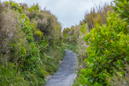
Closer to our finish, we see foliage again. Soon after this picture was taken, we enter into a dense, native forrest where the trail concludes.
I’m glad this walk is over, though it marks the beginning of the end for our trip. We have a few more walks planned, but nothing of this magnitude.
Rotorua and Auckland are next.

You must be logged in to post a comment.