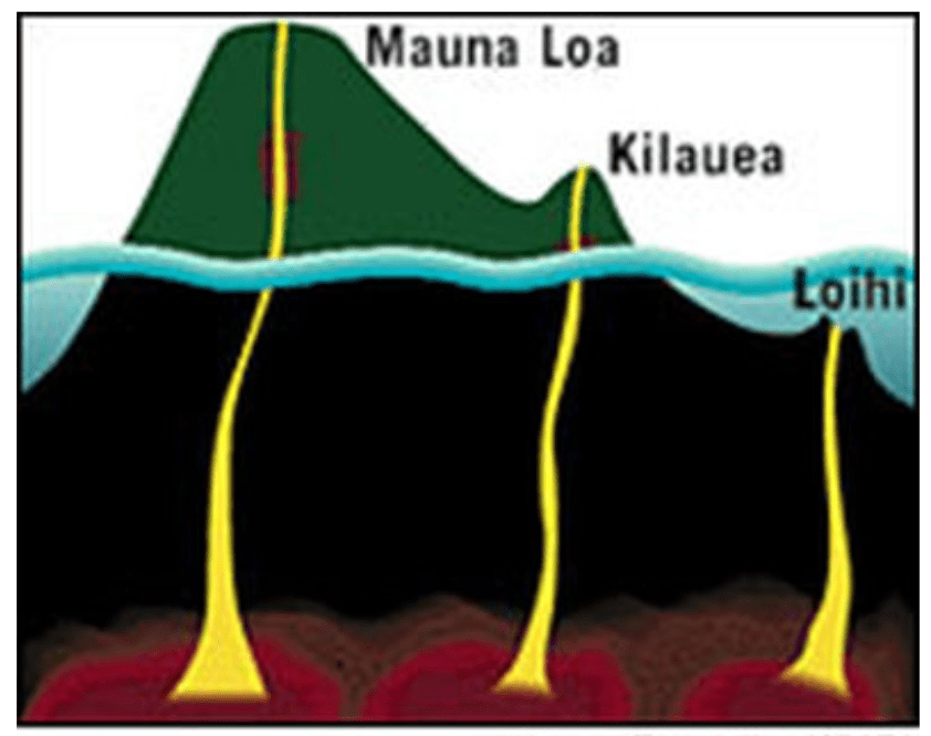
Why a giant hot spot sits under Hawaii in the middle of the Pacific plate is a mystery. “Hot spot” and “dark matter” share an origin story: scientists made the terms up to explain a phenomena that we don’t fully understand. Is what’s beneath Hawaii a large magma plume? Is the crust thinner, and if so, why? Why are there discrete islands instead of a long, single stretch of cooled volcanic rock? All that water pressing down, is it seeping down and bubbling back up with magma? The debate continues.

Volcanos of the big island, which are many. Hilo is located on east, the right of the image. The gentle slope of the land make it extremely susceptible to tsunamis.
All the while the plate continues its slow craw north and west. Remember, tectonic plates move at the speed your fingernails grow. While imperceptible, it is not insignificant given time. Haleakala (on Maui), Mauna Kea, and Mauna Loa are tallest only because they are new and have not had time to erode into the ocean. They are less than a million years old. Babies, essentially. By contrast the island of Kaua’i is about 5 million years old. The oldest islets, the leeward islands part of the Hawaiian Archipelago that nobody mentions and only researchers visit, are over 50 million years old and tiny. The sea always collects, eventually.
The new game in town is Kilauea, which usually oozes lava. It is young, parts only 100,000 years old, and it sits at the extreme east and south end of the big island. Wanna go younger? The super-duper new game in town is Loihi, a submarine volcano located off the coast, again to the south and east, of Kilauea. By some estimates in 200,000 years Loihi will breach the ocean surface and Hawaii will have a new island, bringing the total to 138.
We traveled to Mauna Loa and Volcano National Park from Hilo, which is about an hour ride uphill. The peak is approximately the same as Mauna Kea, but the mountain has way more mass, much like me when compared to other men my height.
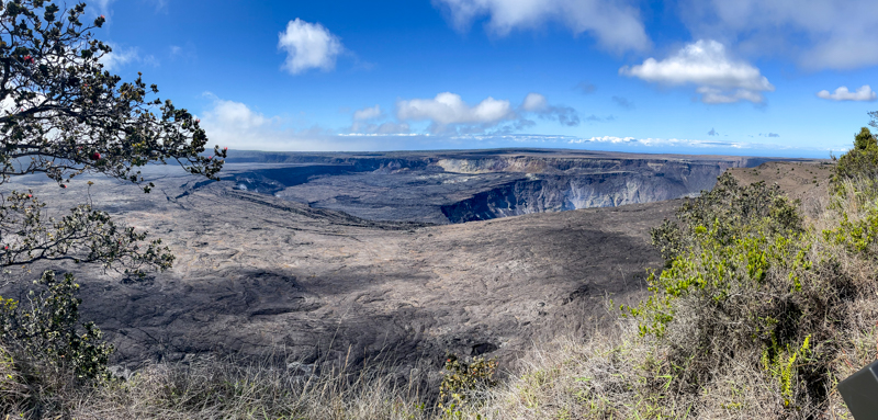
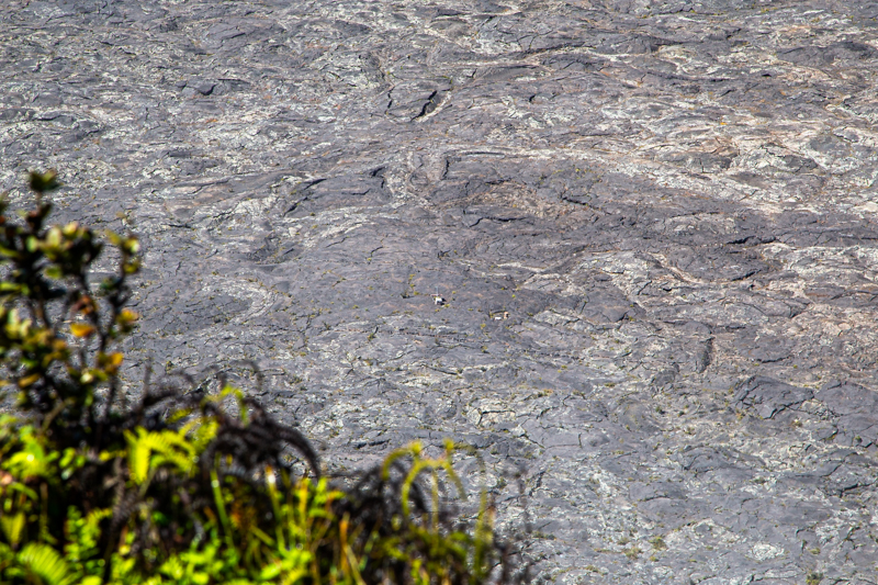
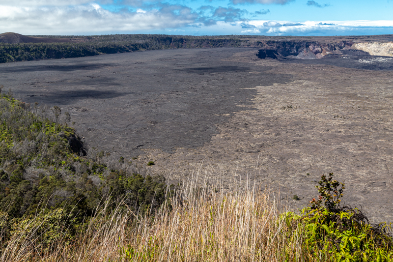
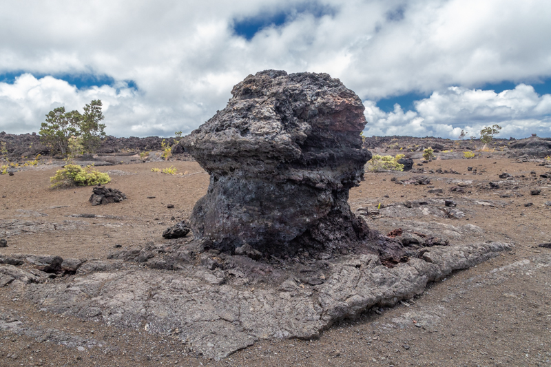
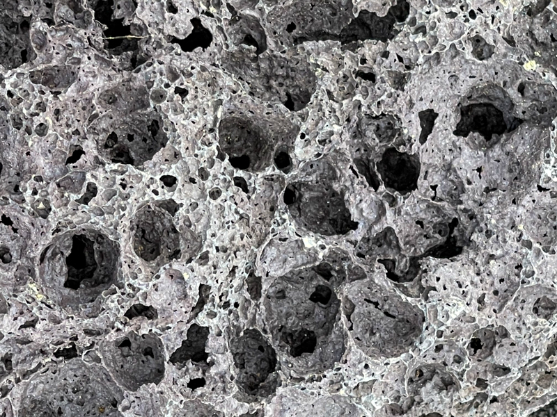
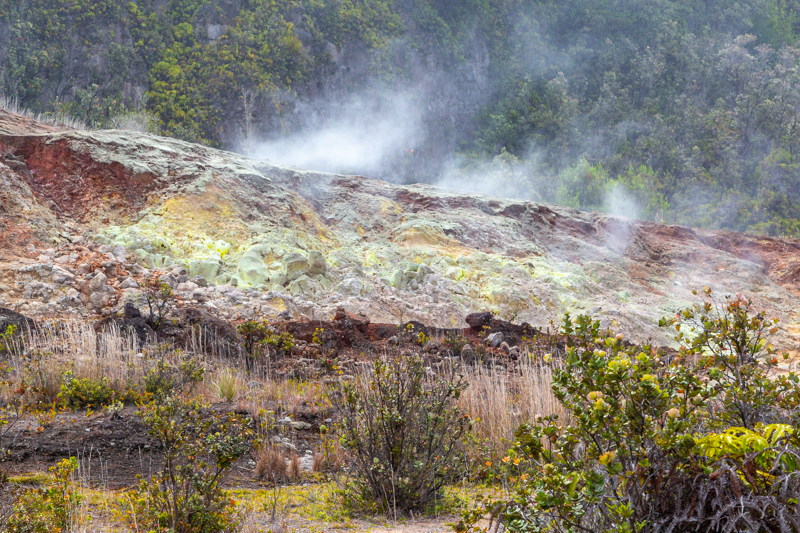
Nothing was erupting and no lava was visible. The volcano is quiet for now. The lava lake, now enlarged from the 2018 eruption, has frozen over. Down the sides from the caldera were old lava flows from years past, each helping to build out the big island. We played around in several lava fields, the landscape alien and forbidding. Exploring them was a definite highlight. With enough imagination, you can still see how the lava flowed downhill, splashing here, collecting there, like any old river flowing to the sea.
Afterwards we drove along the southern loop road to Holualoa, a small town located in the Kona region. We passed the most southern point of the United States, and the bar at the southern most point in the United States. It is a very remote area and worthy of exploration. However, we had places to be and could but just ponder what life might be like at the bottom of Big Island, away from, well, everything.

You must be logged in to post a comment.